The Flat Lolland
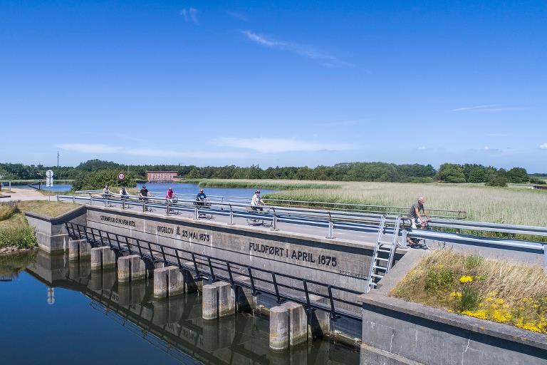
Southern Lolland’s characteristic flat terrain is due to its contained areas. The entire southern Lolland coast is surrounded by a dyke, which was built after the largestorm flood of 1872.
Route description
The storm flood brought so much water into the old Rødby Fjord, that it was connected to Nakskov Fjord in the west, thereby making south-west Lolland an island. Rødby Fjord was later dammed and drained, with works concluding in 1966.
The route starts in the village Kramnitze, and stretches westwards through the village Hummingen. The Kramnitze harbour used to be the entrance to the Rødby fjord. Here, barges could unload their cargo.
At Hummingen, the tour goes up onto the dyke, providing wonderful views of the contained land and Fehmarn Belt. After three kilometres, turn towards
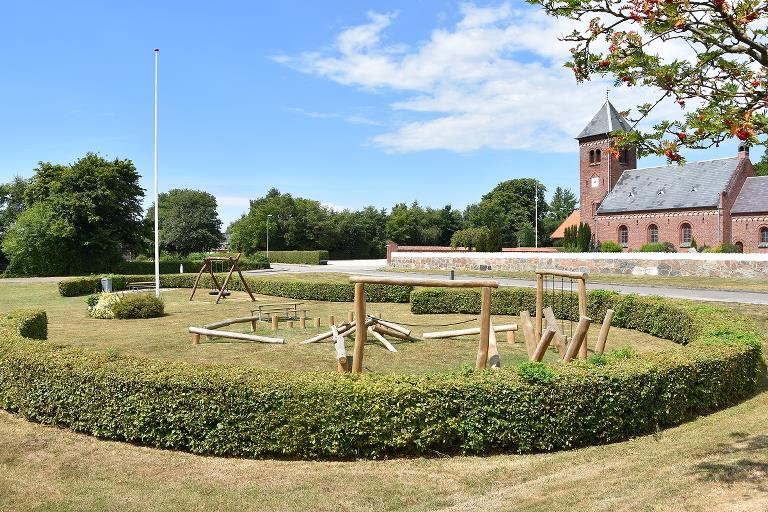
Dannemare - the largest town on the route. In Dannemare there are shopping and accommodation facilities and a lovely church. Continue towards Tillitze, with its church and a small bicycle ’pitstop’.
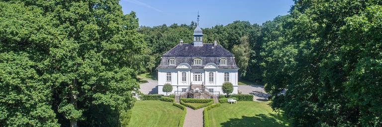
The castle Vindeholme Slot and the surrounding forest Lindeskov mark the halfway point on the route. The Lindeskov forest is one of the few places in Denmark, at which you can find the original small-leaved lime tree. The route will take you back to Dannemare – only this time it continues in the direction of the villages Gloslunde and Hoby. Gloslunde has a small museum with exhibits about the 1872 storm flood.
In 1920, a chieftain’s grave was found in Hoby, containing grave goods from the Early Roman Iron Age. The bicycle route then takes you back to Kramnitze.
Practical information
The bicycle route is signposted with blue signs - you just need to follow the castle symbols: ”slottet”.
Along the bicycle route, you will also encounter signs with symbols and numbers from other routes; the Danish national bicycle route 8 - The Baltic Sea Route, The Monk Road (89) and Naturlandet Rundt (N).
We recommend following the route in the direction that follows the numbers on the map. The entire length of the bicycle route is signposted in this direction.
Refreshments can be purchased along the route, in the town of Dannemare.
Public transport
The bicycle route can be started in Dannemare. You can get to and from Dannemare with a bus, which can also carry your bicycle. Naturlandet recommends Rejseplanen for bus and train schedules.
Experiences and attractions
- Kramnitze: Lovely little harbour, summerhouse area and campground. Public toilet and Naturlandet shelter area.
- Rødby Pumping Station: One of Northern Europe’s largest; pumps approximately 20,000 litres of water per second, to keep the old Rødby Fjord dry.
- Hummingen: Summerhouse area and lovely swimming beach; regularly used by locals and holiday guests.
- Dannemare: Lovely little town with 400 inhabitants. Spoil yourself with a rest on the lawn in front of the church and enjoy the peace and quiet. Dannemare is a good place to start/end the bicycle route.
- Vindeholme Castle: An exquisitely beautiful little castle; located in the forest with views of the Baltic Sea. The castle can be rented for a weekend away, parties and other occasions. Vindeholme Castle has become an icon of this lovely bicycle tour.
- Storm Flood Museum and Memorial Park: The Gloslunde vicarage has a permanent exhibition about the 1872 storm flood - seen through the eyes of the residents of south-west Lolland. Across the road you’ll find a small memorial garden and a large stone with the names of all the storm flood victims.
- Exhibition Made From Popsicle-Sticks: In the vicarage, beside the Storm Flood Museum, you will find an exhibition with various models, built totally from popsicle-sticks. All the models were built by Erland K. Nielsen, who unfortunately died in 1999.
- The Hoby Discovery: Learn more about this fascinating discovery that provides insights into the early Roman Iron Age. Amongst other items, two exceptional silver cups were found in Hoby. They weigh about one kilo (two pounds), and they are beautifully decorated. You can see a copy of the silver cups at the Museum Lolland-Falster.

Gpx fils
Download the gpx file for the route - The Flat Lolland. The file contains the route's GPS data, and can be used to transfer the route to your Garmin watch and other apps. Remember you can find the route digitally in the Naturlandet Lolland-Falster app without needing the gpx file.