Moors, Mill and Movement
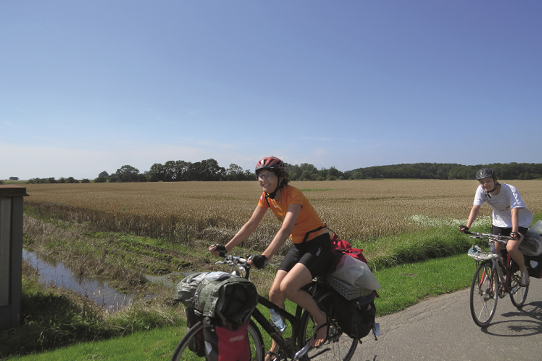
Moors, Mills and Movement is a lovely bicycle route of 20 km. The starting point is in Nysted, at the tourist information centre by the harbour.
Route description
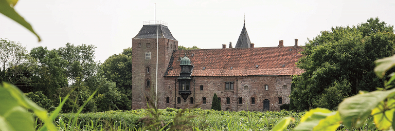
The bicycle route winds over the flat coastal area west of Nysted, past Ålholm Castle, the idyllic village of Stubberup and the beautiful Herritslev Moor - by the Baltic Sea.
Have a rest at the picnic area at Stubberup Moor, or wait until you get to Bregninge church in the village of Grønnegade. The tiny church has no bell tower, instead the bell hangs from a wooden bell stand.
East of Grønnegade the route passes two fine dolmens, burial chambers from the stone age.
In Kettinge, visit a former quarry that has been converted into a park. Visit the mill and purchase refreshments.
The entire route follows minor roads with little traffic, in a comfortable, flat landscape.
Practical information
The bicycle route is signposted with blue signs - you just need to follow the windmill symbols.
Other bicycle routes you may encounter on the way are The Prehistory Route (dolmen), Naturlandet Rundt (N), and the Monk Road (88).
We recommend following the route in the direction that follows the numbers on the map. The bicycle route is signposted in this direction. You will also come across a sign every time the route turns. If there isn’t a sign, then just follow the road.
Food and refreshments can be purchased in Nysted and Kettinge.
Public transport
The bicycle route starts at the tourist information centre at Nysted harbour. You can get to the harbour with a bus, which can also carry your bicycle. Naturlandet recommends Rejseplanen for bus and train schedules.
Experiences and attractions
-
Ålholm Castle: The oldest parts of the castle are from the 1300s. The castle is privately owned and there is no public access.
-
Ålholm Hestehave forest: Small forest with park area and a manorly air. Formerly used as grazing area for Ålholm Castle’s horses. Open to the public. A walk around the park is approx. 4 km long.
-
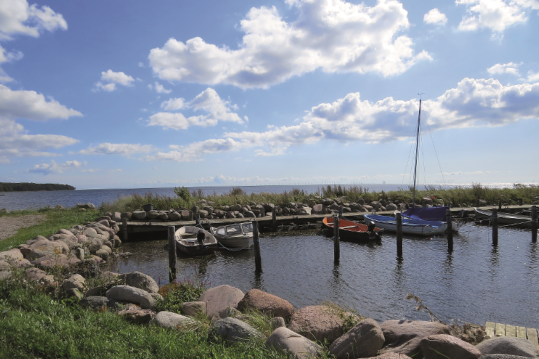
Stubberup: Little, idyllic village with many well-preserved historical half-timbered houses, a marina, beach and a small holiday centre.
-
Stubberup Moor: An overgrown high moor surrounded by lovely natural scenery. There is a good trail to a picnic area by the moor from Stubberup.
-
Herritslev Moor: Grazed saltmarshes and moor areas all the way out to the coast. There is a lovely view of the moor and sea from the road.
-
Bregninge Church: Tiny medieval church with no bell tower, features a wooden bell stand. There is a copy of a Viking Age runestone in the churchyard.
-
Dolmens at Grønnegade: Two well-preserved Stone Age dolmens, located close to the road.
-
Kettinge Quarry: Former quarry converted to a park and nature area. The quarry has a nature playground and picnic benches.
-
Kettinge Mill: Restored Dutch windmill, open certain days in the summer.
-
Kettinge Church: Medieval church with significant frescoes: Kettinge is a road church and therefore open to the public some week days.
-
Nysted: Charming market town with many fine historical houses and a lively marina with restaurants, tourist information and much more. Lovely beach just east of the town, close to the campground.

Gpx file
Download the gpx file for the route - Moors, Mill and Movement. The file contains the route's GPS data, and can be used to transfer the route to your Garmin watch and other apps. Remember you can find the route digitally in the Naturlandet Lolland-Falster app without needing the gpx file.