The Prehistory Route
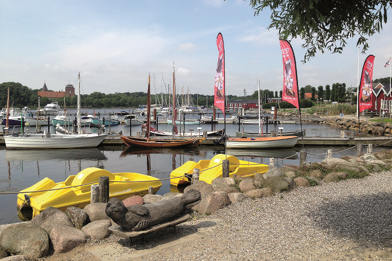
The Prehistory Route is a 25 km bicycle route through lovely natural scenery. The starting point is at the Nysted tourist information office at the harbour.
Route description
The bicycle route passes through the lovely, flat landscape east of Nysted, along the southern and eastern coasts of Lolland, with fantastic views of the Baltic Sea and Guldborg Sound. The route also goes through numerous small, idyllic villages and two large forests.
A good place for a rest is at Holten Strand, where there is a large public area with picnic benches, a shelter area, campground and a lovely swimming beach with a pier, so remember your bathing suit!
The tour passes through a fenced-off area in Roden Forest, where there are many fallow deer and a small
population of completely white fallow deer. Look out for white-tailed sea eagles when you get to the saltmarshes near the forest. The eagles often hunt at the coast here.
As its name indicates, this bicycle route is a theme-route with a focus on experiencing the numerous prehistoric monuments located along the way.
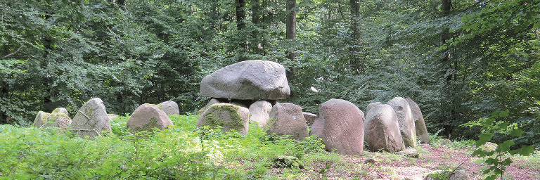
The route winds its way past more than 150 prehistorical monuments. Most of them are in the Frejlev Forest, where it is recommended that you visit the sites that are easy to access and signposted. The ’Backbreaker Stone’ (Knækkerygsten) is on the route - where it is said that a nasty bailiff lost his life, and the ’Rogues Cross’ (Skalkekors) which is part of the same story.
After Frejlev, the tour continues to Kettinge then back to Nysted.
Practical information
The bicycle route is signposted with blue signs - you just need to follow the dolmen symbols: ”dyssen”.
Other bicycle routes you may encounter on the way are Moors, Mills and Movement (windmill), Naturlandet Rundt (N), and the Monk Road (88).
We recommend following the route in the direction that follows the numbers on the map. The bicycle route is signposted in this direction. You will also come across a sign every time the route turns. If there isn’t a sign, then just follow the road.
Food and refreshments can be purchased in Nysted and Kettinge. Fresh water is available at Holten Beach.
Public transport
The bicycle route starts at the tourist information centre at Nysted Harbour. You can get to the harbour with a bus, which can also carry your bicycle. Naturlandet recommends Rejseplanen for bus and train schedules.
Experiences and attractions
-
Nysted redoubt: The redoubt, at the entrance to Nysted, was part of the Danish coastal defences during the wars with England, between 1807-1814.
-
Nysted franciscan abbey: A large and important Catholic abbey. It was demolished after the Reformation, the only reminder is a signpost, telling the story of the abbey.
-
Rødsand: On a clear day you can see the off-shore wind turbines at Rødsand.
-
Holten beach: Public area with shelter, campground, picnic area and pier. Just east of the area is a lovely little dolmen.
-
Roden forest: Fenced, private forest with the remains of a star-shaped trail network used for hunting.
-
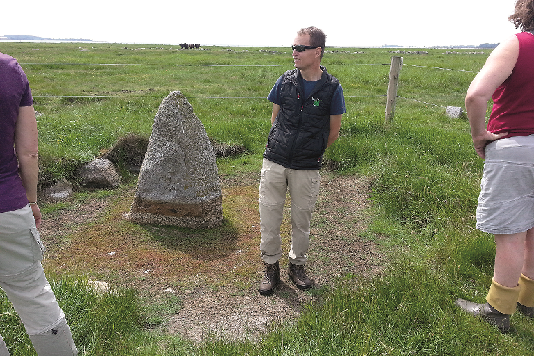
The Backbreaker Stone: Site of the punishment of a nasty bailiff by local farmers.Fantastic stone-strewn saltmarsh area with views of Guldborg Sund strait.
-
150 Prehistoric monuments in Frejlev forest: Follow the signs from the road and visit the historical monuments on the marked ”yellow trail”. A lovely tour of less than 3 km, if you visit all the signposted sites on the route. It is possible to take your bike with you, but some parts of the track are best walked.
-
Great and Small Guldhøj (Gold barrow): Well-preserved passage graves that can be seen from the road.
-
The Rogues’ Cross: Take a break and read the story of the roguish peasants that tried to fool the king.
-
Barnehøj (childs barrow): 30 metre long neolithic long barrow just by the main road.
-
Kettinge church: Medieval church with significant frescoes. Kettinge is a road church - open to visitors most week days.
-
Kettinge mill: Restored Dutch mill open in the summer.

Gpx file
Download the gpx file for the route - The Prehistory Route. The file contains the route's GPS data, and can be used to transfer the route to your Garmin watch and other apps. Remember you can find the route digitally in the Naturlandet Lolland-Falster app without needing the gpx file.